
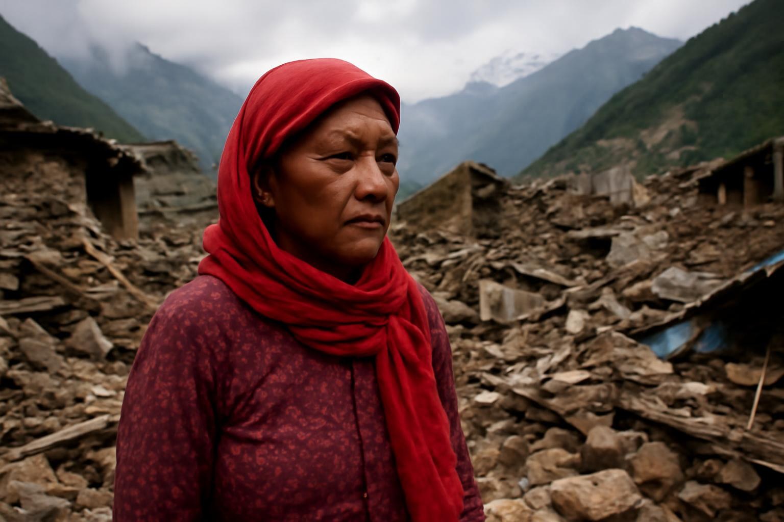
네팔 재해, 히말라야의 기후 위험에 경종을 울리다

게시일:2026-09-02 世界與新聞 Level 4
네팔 재해, 히말라야의 기후 위험에 경종을 울리다
01

About This Article

이 기사에 대하여
배경
히말라야 지역의 빙하, 빙퇴석호, 고산 하천은 기온과 강수량의 변화에 매우 민감하다. 최근 네팔에서 발생한 홍수, 산사태, 빙하호 붕괴 위험은 기후 변화가 산악 지역의 재해를 어떻게 증폭시키는지에 대해 국제 사회의 관심을 불러일으켰다.
  • 네팔 재해가 히말라야 지역의 기후 위험을 부각하다
  • 빙하 융해와 극한 강우 증가로 복합 재해 발생
  • 산악 지역 공동체가 인프라와 구조 활동의 제약에 직면하다
  • 과학적 모니터링과 기후 적응을 위해 장기적인 투자가 필요하다
02

Listen First

먼저 듣기
00:00 / 00:00
03

Reading

기사 읽기
English

A recent disaster in Nepal has renewed concern about the accelerating climate risks confronting communities in the Himalayas. The region is warming rapidly, while changes in precipitation are making rainfall patterns less predictable. When intense rain falls on unstable slopes or combines with melting snow and ice, a localized event can become a cascading emergency.

One major hazard is the growth of glacial lakes behind natural dams made of rock and ice. As glaciers retreat, meltwater can accumulate in these depressions, increasing pressure on fragile barriers. If a dam collapses, a glacial lake outburst flood can send a sudden surge through valleys, destroying bridges, roads, farmland, and settlements with little time for evacuation.

Rainfall-driven disasters are becoming equally consequential. Steep terrain channels water quickly, and deforestation, road construction, and poorly planned development can weaken slopes further. Landslides may bury homes and isolate villages, while sediment can clog rivers and damage hydropower facilities downstream.

The danger is not limited to the physical landscape. Mountain economies often depend on agriculture, tourism, hydropower, and cross-border trade, all of which require reliable roads and communication networks. When a bridge is swept away or a trail becomes impassable, residents may lose access to markets, schools, medical care, and emergency assistance for weeks.

Scientists have improved satellite observation and remote sensing, but monitoring remains difficult in high-altitude environments. Weather stations are sparse, electricity and telecommunications can be unreliable, and cloud cover may obstruct observations at critical moments. Data therefore need to be combined with local knowledge, field inspections, and models capable of representing rapidly changing mountain conditions.

Adaptation must address both immediate safety and long-term planning. Authorities can map high-risk zones, restrict construction in exposed corridors, reinforce bridges, and establish evacuation routes that communities practice regularly. They also need to maintain roads and warning equipment before the monsoon, rather than treating preparedness as a response that begins only after a disaster.

Nepal’s experience carries implications for the entire Himalayan region. Climate change does not create every landslide or flood, but it can alter the probability, intensity, and consequences of hazards that already exist. Effective adaptation will require sustained financing, transparent risk information, and cooperation among governments, researchers, and local communities, because rivers, glaciers, and atmospheric systems do not stop at national borders.

한국어 번역

최근 네팔에서 발생한 재해로 인해 히말라야 지역 공동체가 직면한 가속화되는 기후 위험에 대한 우려가 다시 커지고 있다. 이 지역은 빠르게 온난화되고 있으며, 강수량의 변화로 강우 양상을 예측하기도 더욱 어려워지고 있다. 불안정한 경사면에 집중호우가 내리거나 녹고 있는 눈과 얼음이 강우와 결합하면, 국지적인 사건이 연쇄적인 비상사태로 번질 수 있다.

주요 위험 중 하나는 바위와 얼음으로 이루어진 자연 제방 뒤에서 빙하호가 커지는 것이다. 빙하가 후퇴하면서 녹은 물이 이러한 움푹 팬 지형에 고일 수 있고, 그 결과 취약한 장벽에 가해지는 압력이 커진다. 제방이 무너지면 빙하호 붕괴 홍수가 갑자기 계곡을 휩쓸며, 대피할 시간이 거의 없는 상황에서 다리, 도로, 농경지, 정착지를 파괴할 수 있다.

강우로 발생하는 재해 역시 그 영향이 점점 커지고 있다. 가파른 지형은 물을 빠르게 한곳으로 모으고, 삼림 벌채와 도로 건설, 계획이 부실한 개발은 경사면을 더욱 약화시킬 수 있다. 산사태는 주택을 매몰시키고 마을을 고립시킬 수 있으며, 퇴적물은 하천을 막고 하류의 수력 발전 시설을 손상시킬 수 있다.

위험은 물리적인 지형에만 국한되지 않는다. 산악 지역의 경제는 농업, 관광, 수력 발전, 국경 간 무역에 의존하는 경우가 많으며, 이 모든 활동에는 안정적인 도로와 통신망이 필요하다. 다리가 떠내려가거나 산길을 이용할 수 없게 되면 주민들은 수주 동안 시장, 학교, 의료 서비스, 긴급 지원을 이용하지 못할 수 있다.

과학자들은 위성 관측과 원격 감지 기술을 개선해 왔지만, 고지대 환경에서 모니터링을 실시하는 일은 여전히 어렵다. 기상 관측소가 드문 데다 전력과 통신이 불안정할 수 있고, 구름이 중요한 순간에 관측을 방해할 수도 있다. 따라서 데이터는 지역 지식, 현장 조사, 그리고 급변하는 산악 환경을 반영할 수 있는 모델과 결합해야 한다.

적응 대책은 즉각적인 안전과 장기적인 계획을 모두 다루어야 한다. 당국은 고위험 지역을 지도에 표시하고, 위험에 노출된 통로에서의 건설을 제한하며, 다리를 보강하고, 지역 공동체가 정기적으로 훈련하는 대피 경로를 마련할 수 있다. 또한 우기가 오기 전에 도로와 경보 장비를 정비해야 하며, 재난 대비를 재해가 발생한 뒤에야 시작하는 대응 활동으로 여겨서는 안 된다.

네팔의 경험은 히말라야 전역에 중요한 시사점을 준다. 기후 변화가 모든 산사태나 홍수를 일으키는 것은 아니지만, 이미 존재하는 위험이 발생할 가능성, 강도, 그리고 그 결과를 변화시킬 수 있다. 효과적인 적응을 위해서는 지속적인 재원, 투명한 위험 정보, 정부와 연구자 및 지역 공동체 간의 협력이 필요하다. 강과 빙하, 대기 시스템은 국가 경계에서 멈추지 않기 때문이다.

04

Key Words

핵심 단어·구
5 개
05

Expressions

관용 표현
5 개
06

Practice

이해도 테스트
5 문항 +토론 3문항
0 /0문항

1 What can happen if a natural dam holding a glacial lake collapses?
정답입니다. 오답입니다. 정답은 초록색으로 표시했습니다.
2 Which activities can weaken mountain slopes, according to the article?
정답입니다. 오답입니다. 정답은 초록색으로 표시했습니다.
3 Why can a damaged bridge have consequences beyond transportation?
정답입니다. 오답입니다. 정답은 초록색으로 표시했습니다.
4 What makes high-altitude monitoring difficult?
정답입니다. 오답입니다. 정답은 초록색으로 표시했습니다.
5 What is the article’s main conclusion about climate change?
정답입니다. 오답입니다. 정답은 초록색으로 표시했습니다.

Discussion

질문과 토론
3 문항

아래 질문에는 정답이 없습니다. 영어로 자신의 생각을 한 문항당 3~5문장으로 말해 보세요.

  1. 1 Which adaptation measures should Himalayan communities prioritize, and how could they be funded?
  2. 2 How can local knowledge improve scientific monitoring and disaster preparedness in remote mountain areas?
  3. 3 What responsibilities should countries share when a river or glacier system crosses national borders?